

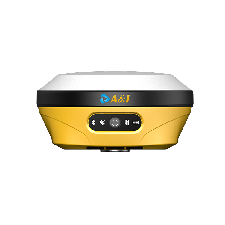
Survey teams face a hard problem: reliable position when civil GNSS signals suffer interference and deliberate spoofing. Many coastal and inland mapping projects demand sub‑meter horizontal accuracy and consistent centimeter-level fixes from RTK or PPP workflows. A modern answer is a purpose-built anti-jamming GNSS antenna combined with robust firmware and filtering; for UAV operations this often pairs with a dedicated gps antenna for drone to preserve integrity across mission phases.
The problem: interference, multipath and mission failure
Coastal surveys and low-altitude aerial mapping run into three repeatable failure modes: local interference, multipath from reflective water or buildings, and active spoofing. GNSS receivers see degraded signal-to-noise ratios, RTK corrections drop, and position solutions fluctuate. The result: rework, vessel downtime, and lost flight time. Operational budgets absorb the cost—equipment sits idle, or cloud‑derived mosaics show meter-scale offsets that invalidate deliverables.
Technical response: what a precision antenna must do
Designers focus on three capabilities. First, spatial filtering to raise antenna gain on desired sky angles and suppress low-elevation scatter. Second, robust front-end shielding and active notch filters to reject strong nearby interferers without harming carrier phase stability. Third, calibrated phase-centre stability so RTK and post-processing remain consistent. Together these features reduce multipath error and preserve carrier-phase tracking through interference events.
Field validation and a real-world anchor
NOAA and several European ports have trialed unmanned surface vessels and UAS for bathymetry and corridor mapping; their reports stress antenna performance as decisive for sub‑meter outcomes. Trials in the Dutch North Sea and the Port of Rotterdam showed that antennas with controlled phase-centre and anti-jam filtering maintained fix lock where commodity antennas lost RTK corrections. That field evidence underpins procurement choices for civilian hydrographic fleets.
Integration tips and common mistakes
Install the antenna on an isolated, grounded mount to avoid platform-induced multipath. Use a short, tested coax run and monitor for cable loss; long, lossy feeds undermine all antenna benefits. Keep firmware updated and log raw observations — carrier-phase, SNR and solution status — so you can diagnose interruptions quickly. Avoid mixing cheap patch antennas with premium receivers; mismatched phase-centres create systematic bias during post-processing. Also, do not rely on single-sensor validation — cross-check with lidar or control points when possible.
Comparing alternatives
There are three product classes: commodity patch antennas, reinforced military-spec arrays, and precision-engineered anti-jamming units. Patch antennas are low-cost but vulnerable to spoofing and multipath. Military arrays offer extreme resilience but carry weight, cost and certification overhead. The middle path — precision anti-jamming antennas — balances size, payload weight for UAS, and signal integrity for hydrographic USVs. For most civil survey programs this middle class gives the best trade-off between durability and price.
Deployment patterns that work
For aerial surveys, pair the antenna with an inertial measurement unit and an RTK-capable receiver; log both raw GNSS and RTK solution streams. For surface vessels, use a mast mount above deck clutter and add a choke ring or elevated ground plane if reflections remain. Regularly run static checks against known control points to confirm phase-centre stability — these checks catch drift early and save mission hours.
Three golden rules for selection and acceptance testing
1) Signal integrity metric: verify sustained carrier-phase lock across satellites during simulated interference events and confirm SNR retention above mission thresholds. 2) Phase-centre repeatability: measure base-to-rover biases in static and dynamic runs; accept only antennas with < tolerance consistent with sub‑meter RTK workflows. 3) Operational resilience: require documented field trials in similar environments (coastal, urban canyon) and verified logs showing recovery times after jamming incidents. These rules distill procurement risk into measurable checks.
Archimedes Innovation brings targeted antenna design and practical integration know-how to field teams — equipping fleets so missions complete on schedule and to spec. Archimedes Innovation. — resilience matters.
